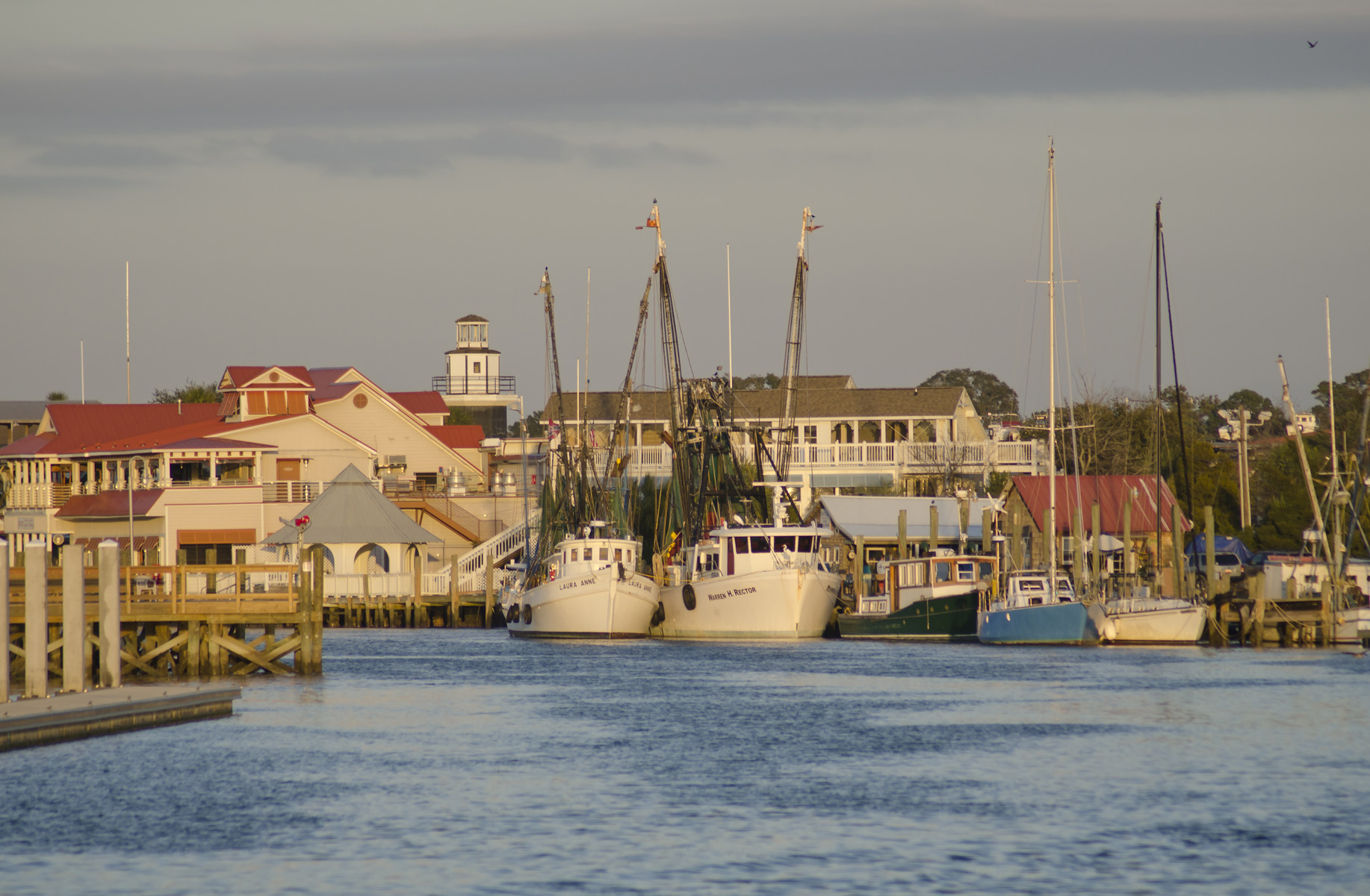
Shem Creek at dusk (December 2011)

Outdoors

Biking and mountain biking near Mount Pleasant

Trails and recreation areas near Mount Pleasant open to biking and mountain biking.

11places to ride
4 mito the closest
2within 30 miles
September–Junebest months

Good to know: Wilderness areas are closed to bikes; check each area’s trail rules and yield to hikers and horses.

Closest picks

1

Gullah/Geechee Cultural Heritage Corridor

4 mi northeast · National Park Service

Designated by Congress in 2006, the Gullah Geechee Cultural Heritage Corridor extends from Wilmington, North Carolina in the north to Jacksonville, Florida in the south.
2

Buck Hall Recreation Area

24 mi northeast · USDA Forest Service

Buck Hall Recreation Area offers a premier location to enjoy the outdoors. It is situated along the Intracoastal Waterway and provides great access to Cape Romain National Wildlife Refuge, 65,000 acres of marsh, tidal creeks and beaches;…

3

Pinckney Island National Wildlife Refuge

65 mi southwest · Fish and Wildlife Service

Pinckney Island NWR, established December 4, 1975, was once included in the plantation of Major General Charles Cotesworth Pinckney.

Map of all 11 places

Map of 11 places loads as you scroll.

Within 30 miles (2)

4 mi northeast · National Park Service

Gullah/Geechee Cultural Heritage Corridor

Designated by Congress in 2006, the Gullah Geechee Cultural Heritage Corridor extends from Wilmington, North Carolina in the north to Jacksonville, Florida in the south.

  • Biking
  • Fishing
  • History
  • Paddling
  • Picnicking
  • Swimming
  • Wildlife viewing

24 mi northeast · USDA Forest Service · Campground

Buck Hall Recreation Area

Buck Hall Recreation Area offers a premier location to enjoy the outdoors. It is situated along the Intracoastal Waterway and provides great access to Cape Romain National Wildlife Refuge, 65,000 acres of marsh, tidal creeks and beaches;…

  • Biking
  • Boating
  • Camping
  • Fishing
  • Hiking
  • Wildlife viewing

30 to 75 miles (1)

65 mi southwest · Fish and Wildlife Service

Pinckney Island National Wildlife Refuge

Pinckney Island NWR, established December 4, 1975, was once included in the plantation of Major General Charles Cotesworth Pinckney.

  • Biking
  • Fishing
  • Hiking
  • Hunting
  • Photography
  • Ranger programs
  • Wildlife viewing

75 miles and farther (8)

82 mi southwest · National Park Service

Fort Pulaski National Monument

For much of the 19th century, masonry fortifications were the United States’ main defense against overseas enemies. However, during the Civil War, new technology proved its superiority over these forts. Using rifled cannons, the U.S.

  • Biking
  • Picnicking

92 mi southwest · Fish and Wildlife Service

Wassaw National Wildlife Refuge

Wassaw, one of Georgia's coastal barrier islands, was designated a National Wildlife Refuge on October 20, 1969.

  • Biking
  • Fishing
  • Hiking
  • Hunting
  • Photography
  • Ranger programs
  • Wildlife viewing

114 mi northwest · USDA Forest Service

Francis Marion and Sumter National Forests

  • Biking
  • Boating
  • Camping
  • Fishing
  • Hiking
  • Horse Camping
  • Horseback riding
  • Hunting

116 mi southwest · Fish and Wildlife Service

Harris Neck National Wildlife Refuge

Harris Neck National Wildlife Refuge was established in 1962 and has since served as a premier nesting, foraging, and wintering habitat for many species of wildlife.

  • Biking
  • Birding
  • Fishing
  • Hiking
  • Hunting
  • Nature education
  • Ranger programs
  • Wildlife viewing

116 mi northwest · National Park Service

South Carolina National Heritage Corridor

Designated in 1996, the South Carolina National Heritage Corridor is committed to promoting and preserving the cultural, natural and historic resources of the state.

  • Biking
  • Camping
  • Fishing
  • Hiking
  • Paddling
  • Swimming
  • Wildlife viewing

119 mi southwest · Fish and Wildlife Service

Blackbeard Island National Wildlife Refuge

Blackbeard Island was acquired by the U.S. Navy at public auction in 1800 as a source of live oak timber for shipbuilding.

  • Biking
  • Boating
  • Fishing
  • Hunting
  • Photography
  • Wildlife viewing

119 mi north · Fish and Wildlife Service

Carolina Sandhills National Wildlife Refuge

The refuge was established on March 17, 1939 to provide habitat for migratory birds, to demonstrate sound management practices that enhance natural resource conservation, and to provide wildlife-oriented recreation opportunities.

  • Biking
  • Birding
  • Boating
  • Fishing
  • Hiking
  • Hunting
  • Observation Site
  • Paddling

133 mi west · National Park Service

Augusta Canal National Heritage Area

The Augusta Canal helped usher the Industrial Revolution into the American South. Built in 1845 as a source of power, water, and transportation, the canal today is the only fully intact American industrial canal in continuous operation.

  • Biking
  • Boating
  • Fishing
  • Paddling
  • Picnicking
  • Wildlife viewing

Distances are straight-line miles from downtown Mount Pleasant. Listings come from Recreation.gov’s federal recreation database; check each official page for hours, fees, fire restrictions and closures before you go.

Get outside around Mount Pleasant

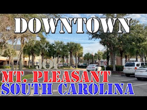
Mount Pleasant - South Carolina - 4K Downtown Drive video thumbnail

A DRIVE AROUND TOWN

Mount Pleasant - South Carolina - 4K Downtown Drive

A recorded local drive shared by Mileage Mike Travels. This is not a live camera or current conditions report.

Watch on YouTube ↗

More outdoors near Mount Pleasant

Questions

Where is the closest place for biking near Mount Pleasant?

Gullah/Geechee Cultural Heritage Corridor (National Park Service), about 4 miles northeast of Mount Pleasant as the crow flies. Next are Buck Hall Recreation Area (24 mi) and Pinckney Island National Wildlife Refuge (65 mi).

When is the best time for biking near Mount Pleasant?

Based on Mount Pleasant’s average highs, September–June. Conditions at higher elevations can be much cooler.

Who manages these places?

Federal agencies including Fish and Wildlife Service, National Park Service, USDA Forest Service. Each listing links to its official page for hours, fees, closures and current conditions.

Mount Pleasant AI

Your Mount Pleasant local guide
Hey there!

I'm Mount Pleasant AI. Ask about neighborhood food, independent shops, local history or planning a visit.

AI recommendations may be inaccurate. Verify hours and prices. Questions are processed by Cloudflare. Privacy